aMetro
Public transport navigator
Version: 2.0.1.6
Added: 02-03-2012
Updated: 31-08-2019
Added: 02-03-2012
Updated: 31-08-2019
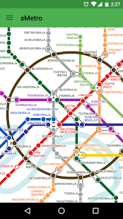
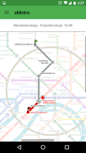
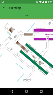
Find the shortest path in public transport (metro, subway, trains and other types of transport), with maps that are compatible with maps from the pMetro project.
- View metro maps and schemes for 180 cities around the world
- View maps for other kinds of transportation
- Zoom maps
- Find the shortest route between selected stations
- Get information about stations
- Update maps automatically
- Find the nearest station next to a user’s location (for selected cities)