Avare
Aviation map
Version: 11.0.2
Added: 12-08-2014
Updated: 07-10-2024
Added: 12-08-2014
Updated: 07-10-2024
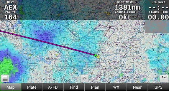
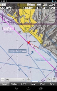
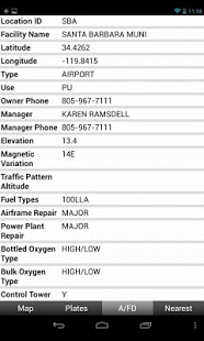
Avare (pronounced "AvAir") is a free moving aviation map. Basic features include
online or offline A/FD info, approach plates and GPS moving map on all FAA VFR
sectionals, WACs and TACs, plus IFR low charts and airport diagrams. Avare also
enables manual browsing of all charts and all other materials even without cell
service or GPS. Current FAA weather METARs, TAFs and TFRs are provided too.
Notice: This is not an FAA certified GPS.