Kwik EFIS
Electronic Flight Information System (COMP)
Version: 6.6rc3
Added: 20-07-2019
Updated: 18-04-2021
Added: 20-07-2019
Updated: 18-04-2021
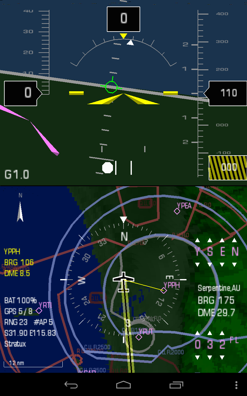
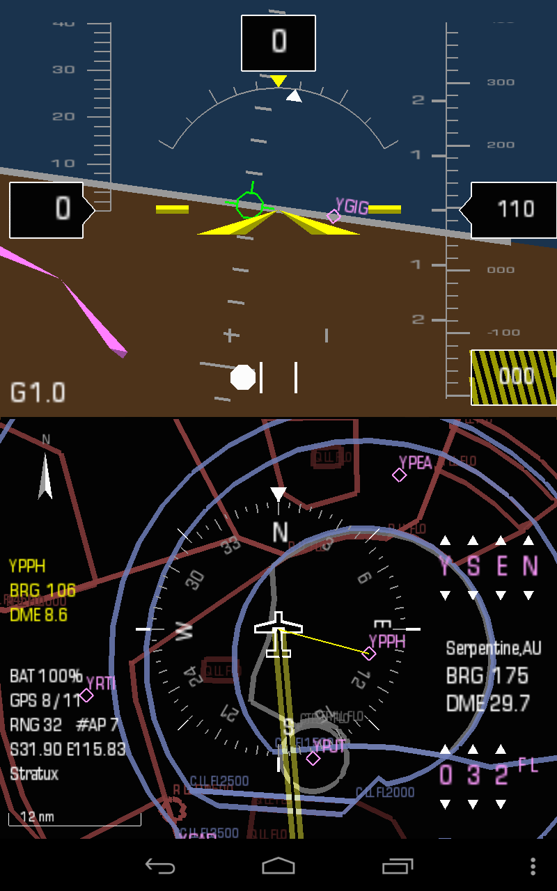
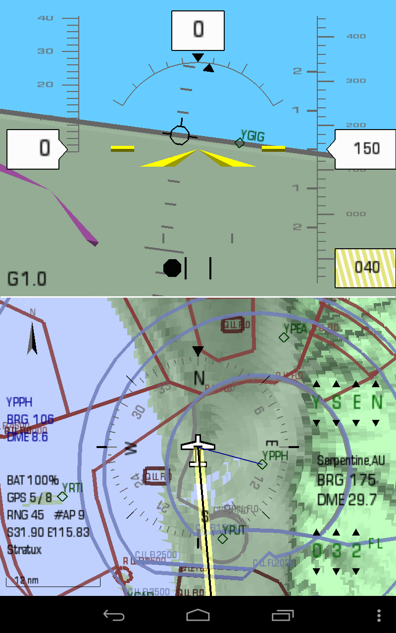
Kwik COMP is a combined application of EFIS and DMAP. It provides a split
screen showing the primary flight display and digital moving map on a single
device. COMP can optionally integrate with the Stratux ADS-B/AHRS to provide
real-time traffic and enhanced attitude information.
Synthetic Vision
Synthetic vision is built from the USGS 3 arc second Digital Elevation Model
data. If enabled, it also allows for some terrain collision detection. The
required terrain data packages are available via F-Droid, see:
North America, Canada
Europe, Russia
Sahara / North Africa, India / Indonesia, Japan
Southern Africa, Australia / New Zealand
South America
Flight Director
Kwik EFIS has a fully functional flight director built in. It uses the standard
V-Bar symbology common to modern flight directors. The target waypoint and
altitude is set on-screen by means of the spinner controls on the right top and
bottom of the screen.
Airspace
Airspace data is provided from Worldwide Soaring Services Turnpoint Exchange Airspace
North West Sector: United States/Canada.
North East Sector: Europe(Denmark, Germany, Switzerland)/Russia.
South West Sector: South America.
South East Sector: Australia/South Africa.
ADS-B/AHRS
In addition to the internal sensors, a low cost Stratux ADS-B/AHRS can be
selected as the input source. See Stratux ADS-B for
more information.
Simulator
There is a simulation mode available in the application. The Flight director is
used to select a waypoint and altitude and the simulator will generate the GPS
movements to navigate to the selected waypoint. The speed is set at the typical
cruise for the currently selected aircraft.
Companion Applications
Kwik EFIS is the primary flight display
application of the EFIS. It provides a modern attitude and flight
instrument display.
Kwik DMAP is a stand-alone digital
moving map application. It provides situational awareness and navigation
functionality.
Help
screen showing the primary flight display and digital moving map on a single
device. COMP can optionally integrate with the Stratux ADS-B/AHRS to provide
real-time traffic and enhanced attitude information.
Synthetic Vision
Synthetic vision is built from the USGS 3 arc second Digital Elevation Model
data. If enabled, it also allows for some terrain collision detection. The
required terrain data packages are available via F-Droid, see:
Flight Director
Kwik EFIS has a fully functional flight director built in. It uses the standard
V-Bar symbology common to modern flight directors. The target waypoint and
altitude is set on-screen by means of the spinner controls on the right top and
bottom of the screen.
Airspace
Airspace data is provided from Worldwide Soaring Services Turnpoint Exchange Airspace
ADS-B/AHRS
In addition to the internal sensors, a low cost Stratux ADS-B/AHRS can be
selected as the input source. See Stratux ADS-B for
more information.
Simulator
There is a simulation mode available in the application. The Flight director is
used to select a waypoint and altitude and the simulator will generate the GPS
movements to navigate to the selected waypoint. The speed is set at the typical
cruise for the currently selected aircraft.
Companion Applications
Kwik EFIS is the primary flight display
application of the EFIS. It provides a modern attitude and flight
instrument display.
Kwik DMAP is a stand-alone digital
moving map application. It provides situational awareness and navigation
functionality.
Help