NextGIS Mobile
GIS that lets you create, edit and export geodata, both online and offline
Version: 3.2.0
Added: 25-07-2016
Updated: 02-08-2026
Added: 25-07-2016
Updated: 02-08-2026
NextGIS Mobile allows to:
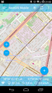
* show multi-layer map (layers can come from online and offline sources);
* change visibility and layers order;
* navigate the map (panning, zoom in, zoom out);
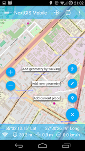
* collect data in the field;
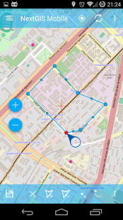
* edit vector data (both geometries and attributes) online and offline;
* record tracks;
* show coordinates, speed, elevation etc.
* show multi-layer map (layers can come from online and offline sources);
* change visibility and layers order;
* navigate the map (panning, zoom in, zoom out);
* collect data in the field;
* edit vector data (both geometries and attributes) online and offline;
* record tracks;
* show coordinates, speed, elevation etc.