PeakNav
The mountains around you in 3D: peaks, paths, ski runs, GPX tracks and the sky
Version: 1.3.3
Added: 20-11-2026
Updated: 20-11-2026
Added: 20-11-2026
Updated: 20-11-2026
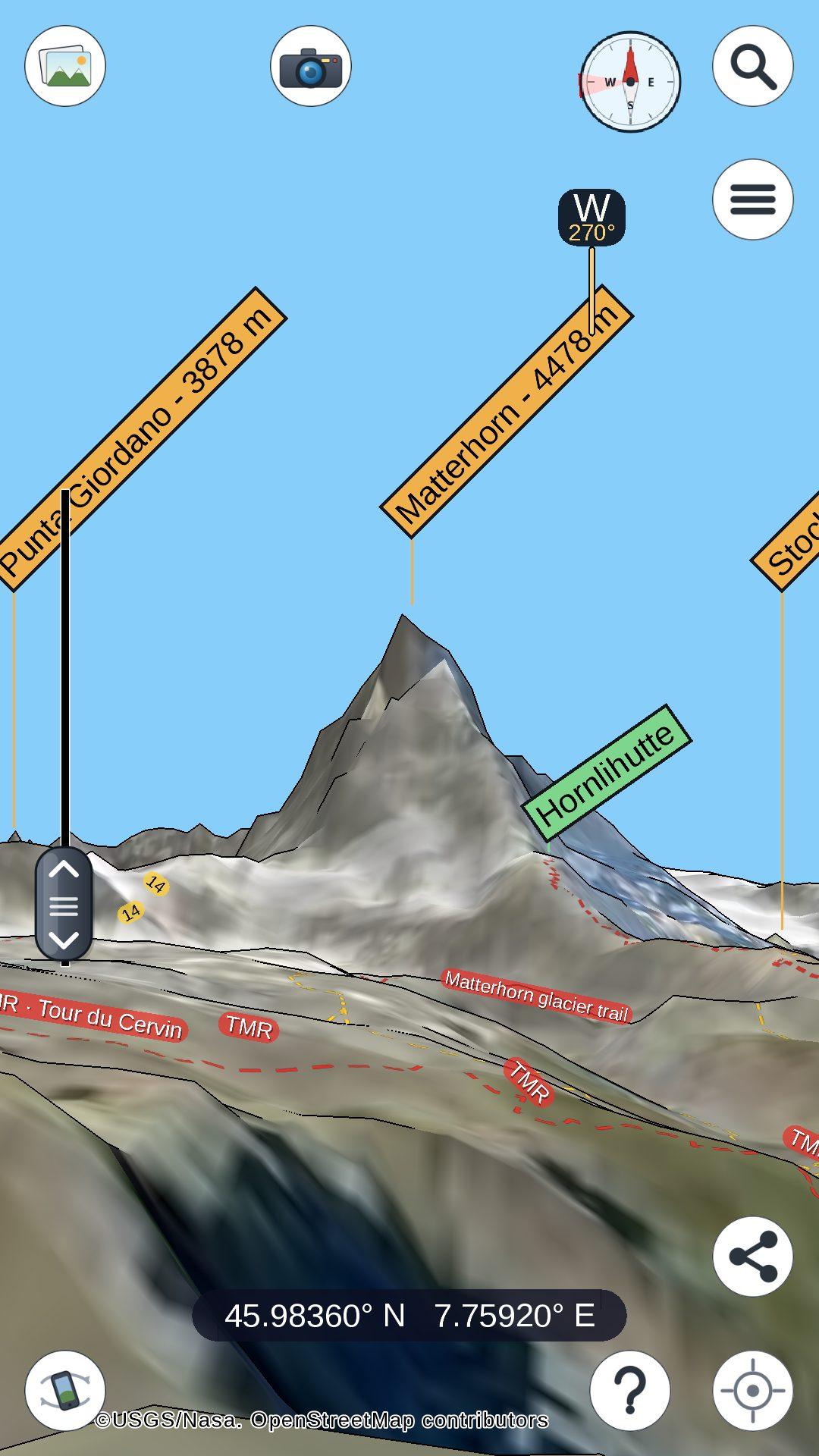
PeakNav draws the mountains of the whole world in 3D: the terrain around any point on Earth, with the names of the nearby peaks, the paths and roads projected onto the slopes, alpine huts, lakes, islands and mountain ranges.
What it does
Data
Terrain from the ASTER GDEM (METI/NASA); paths, roads, ski pistes, lifts, huts and names from OpenStreetMap (ski data via OpenSnowMap); place names from GeoNames and Wikidata; imagery from NASA GIBS and the USGS. The datasets are published openly on Hugging Face, and other imagery sources can be added in the options.
Privacy
The app collects no personal data. Your position, searches and photos stay on the device; the only network traffic is the download of map data and imagery from the providers above, and, when you search for a place, a query to OpenStreetMap's Nominatim.
About this build
Place search in this build is online only: the offline place-name index of the other builds is generated from the GeoNames dumps and is not part of the F-Droid build.
Free software under the GPL v3. Source code and desktop versions (Windows, macOS, Linux) at https://github.com/Upabjojr/PeakNavApp
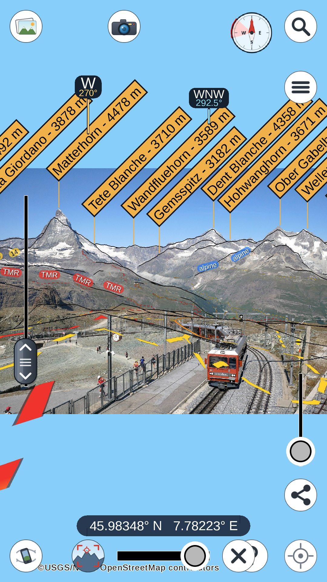
Photo in the picture-overlay screenshot: "GGB 3051 Gornergrat Bahnhof 1 2021-08-21" by Herbert Ortner (CC BY 4.0), on Wikimedia Commons.
What it does
- Shows the mountains around you, or around any place you search, from the ground or from the air; fly to a summit, or orbit around it.
- Names the peaks, huts, towns, lakes, islands and ranges in view, and draws paths and roads onto the terrain, coloured by difficulty and labelled with their names and numbers.
- Ski runs coloured blue, red and black and flowing downhill, and the lifts - cable cars, gondolas, chairlifts, drag lifts - with their cabins and chairs moving uphill, each named.
- Uses the GPS and the gyroscope to show what you are looking at: hold the phone up and the view turns with it.
- Loads a GPX track and flies along it, with a panel showing the distance, the walking time, the ascent, and the elevation profile with the time along the way; "route to here" finds a walk along the mapped paths to any point you tap.
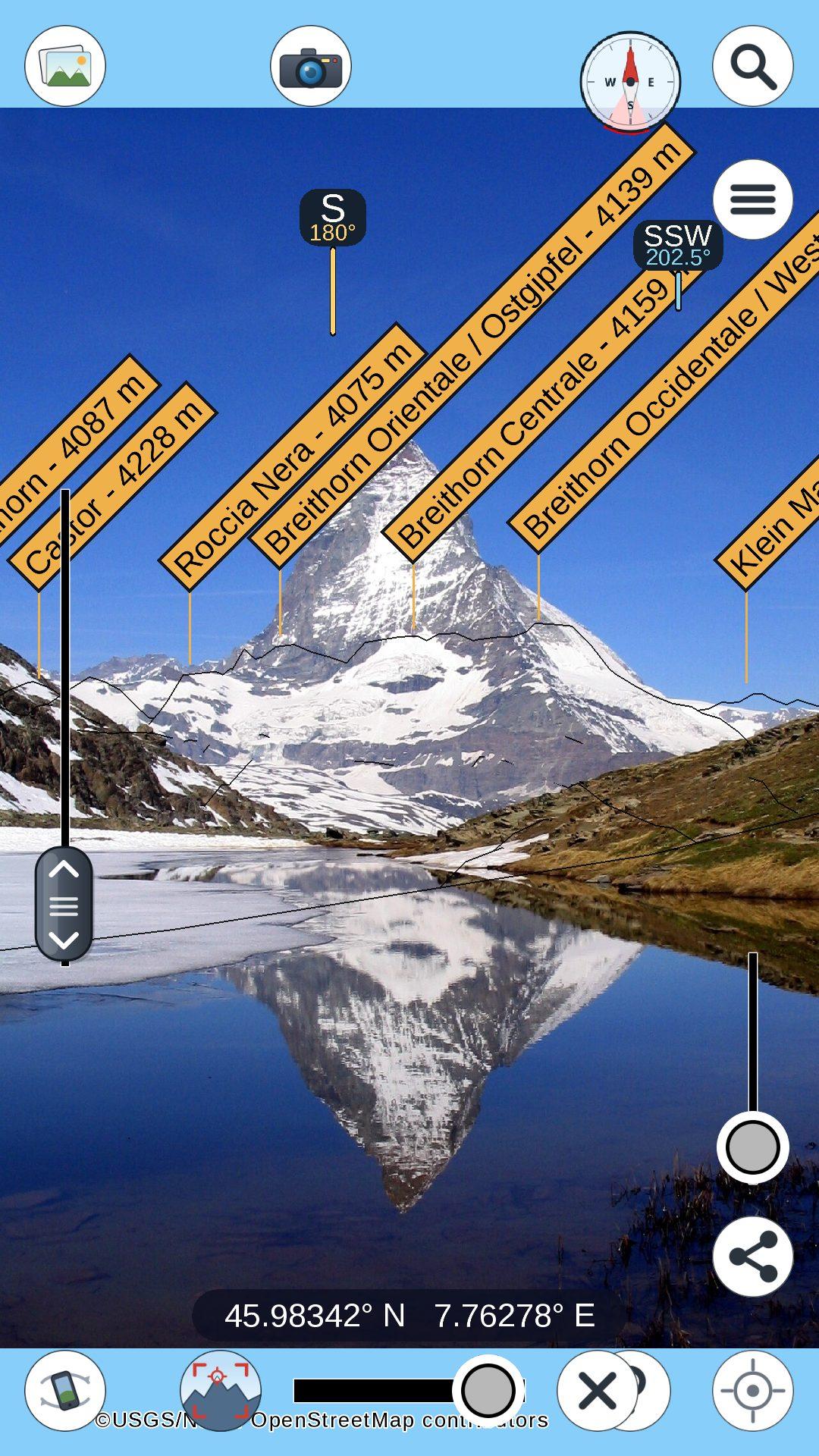
- Puts a photograph behind the terrain and matches its skyline to the mountains, to work out where the camera pointed and name the peaks in the picture.
- Draws the sky as it really is: sun, moon and stars at their true positions for your place and time, constellations, the moon's phase.
- Satellite imagery and sun shading as optional layers; metric or imperial units.
- Works offline once an area has been downloaded: elevation and map data are fetched per area and kept on the device.
Data
Terrain from the ASTER GDEM (METI/NASA); paths, roads, ski pistes, lifts, huts and names from OpenStreetMap (ski data via OpenSnowMap); place names from GeoNames and Wikidata; imagery from NASA GIBS and the USGS. The datasets are published openly on Hugging Face, and other imagery sources can be added in the options.
Privacy
The app collects no personal data. Your position, searches and photos stay on the device; the only network traffic is the download of map data and imagery from the providers above, and, when you search for a place, a query to OpenStreetMap's Nominatim.
About this build
Place search in this build is online only: the offline place-name index of the other builds is generated from the GeoNames dumps and is not part of the F-Droid build.
Free software under the GPL v3. Source code and desktop versions (Windows, macOS, Linux) at https://github.com/Upabjojr/PeakNavApp
Photo in the picture-overlay screenshot: "GGB 3051 Gornergrat Bahnhof 1 2021-08-21" by Herbert Ortner (CC BY 4.0), on Wikimedia Commons.