Roue Libre
Bike sharing: offline map and journeys, with no tracker.
Version: 1.5.2
Added: 29-08-2026
Updated: 15-10-2026
Added: 29-08-2026
Updated: 15-10-2026
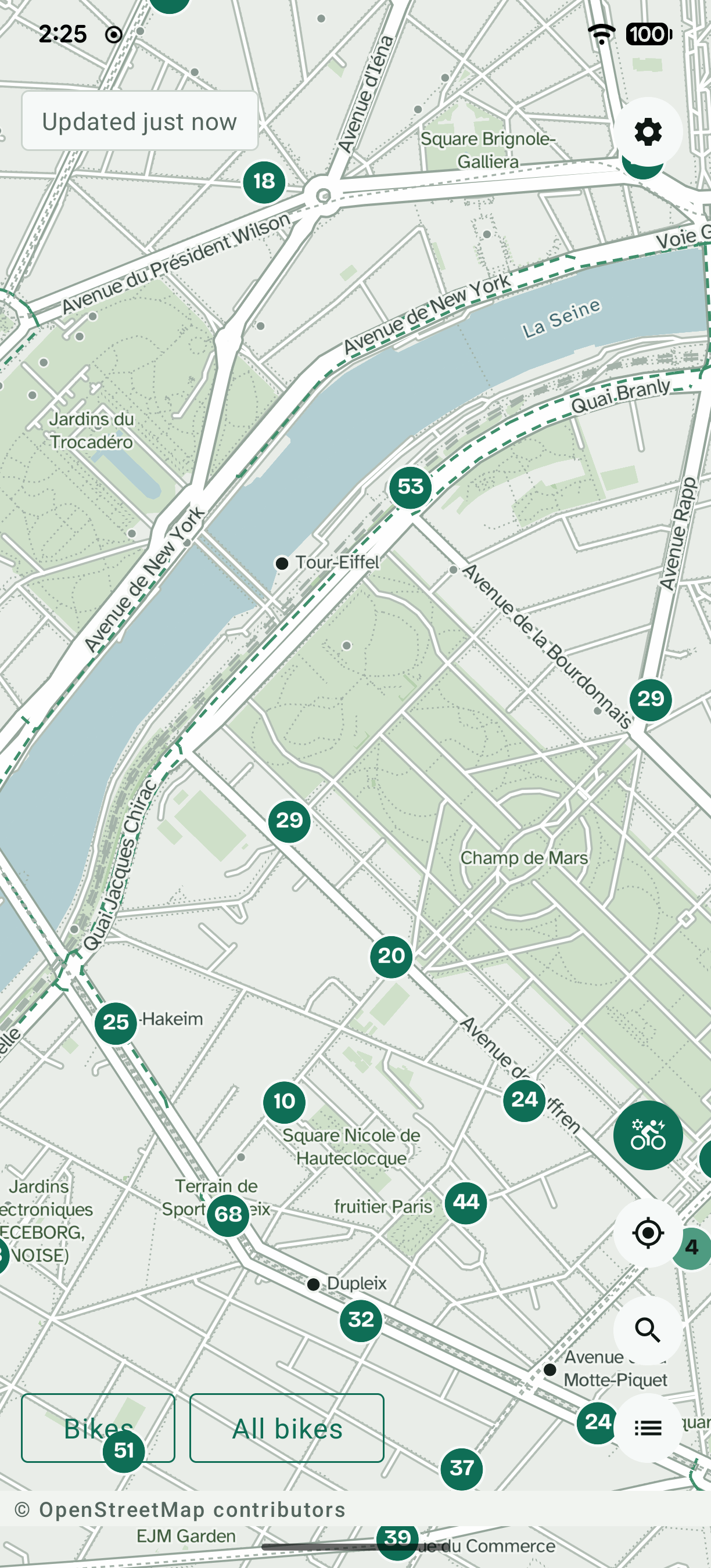
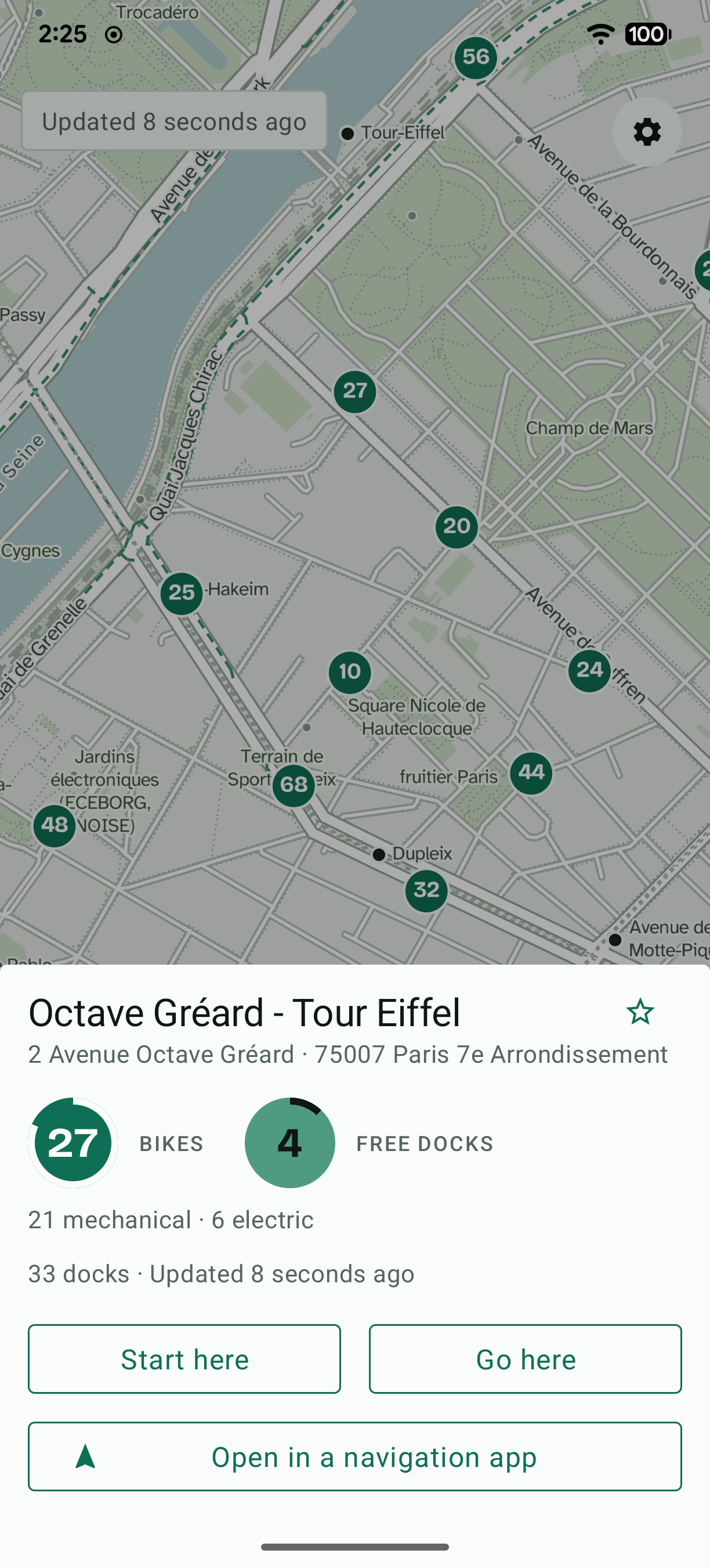
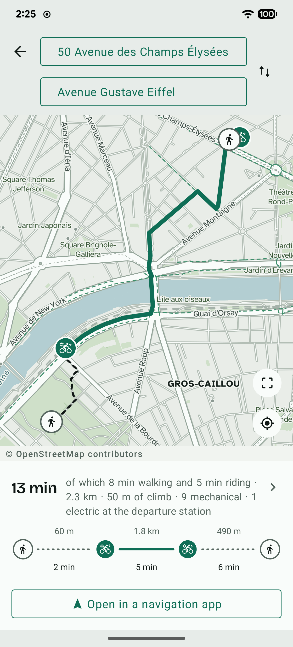
Roue Libre shows bike-share stations on a map and computes a door-to-door journey combining walking and cycling.
Everything runs on the device: the map, the address search and the route computation need no connection at all. Only real-time bike availability goes out on the network.
What sets it apart
• No Google service: no Play Services, no Firebase, no Maps SDK. It runs on any Android OS without Google services.
• No telemetry, no tracker, no unique identifier, no account.
• No journey data kept: no history, no positions, no destinations. What you search for does not leave the phone.
• No city is imposed: several conurbations coexist on the device, and one city's data can be deleted without touching the others.
• The journey optimises the pair of stations — departure and arrival — rather than settling for the nearest, and weighs the risk of a poorly stocked station emptying while you walk to it.
Worth knowing before installing
The map, the routing graph and the address index are not in the application: they are downloaded once, from the storage screen, or installed by hand from files you produce yourself. Their weight follows the city — a few tens of megabytes for a medium-sized conurbation, more for a capital — and it is announced before downloading.
The cities served
Close to three hundred networks, in some thirty countries: every one that publishes its stations as open data and whose docks the journey can rely on — from Vélib' in Paris to Citi Bike in New York, by way of Prague, Barcelona, Copenhagen, Tokyo and Buenos Aires. The application proposes yours from your position, if you ask it to, and you can keep several installed and switch between them.
The offline datasets have been produced for a handful of them so far. For the others, the application says so rather than pretending: the list shows what exists, and the files can be produced with the repository's scripts.
It is tied to no network in particular: the list of cities updates itself, and every city carries the address of its own GBFS feed, which makes the application usable with any GBFS network in the world.
Roue Libre is an independent application, with no link to the networks it serves or their operators.
Free software under the GNU GPL v3 licence.
Everything runs on the device: the map, the address search and the route computation need no connection at all. Only real-time bike availability goes out on the network.
What sets it apart
• No Google service: no Play Services, no Firebase, no Maps SDK. It runs on any Android OS without Google services.
• No telemetry, no tracker, no unique identifier, no account.
• No journey data kept: no history, no positions, no destinations. What you search for does not leave the phone.
• No city is imposed: several conurbations coexist on the device, and one city's data can be deleted without touching the others.
• The journey optimises the pair of stations — departure and arrival — rather than settling for the nearest, and weighs the risk of a poorly stocked station emptying while you walk to it.
Worth knowing before installing
The map, the routing graph and the address index are not in the application: they are downloaded once, from the storage screen, or installed by hand from files you produce yourself. Their weight follows the city — a few tens of megabytes for a medium-sized conurbation, more for a capital — and it is announced before downloading.
The cities served
Close to three hundred networks, in some thirty countries: every one that publishes its stations as open data and whose docks the journey can rely on — from Vélib' in Paris to Citi Bike in New York, by way of Prague, Barcelona, Copenhagen, Tokyo and Buenos Aires. The application proposes yours from your position, if you ask it to, and you can keep several installed and switch between them.
The offline datasets have been produced for a handful of them so far. For the others, the application says so rather than pretending: the list shows what exists, and the files can be produced with the repository's scripts.
It is tied to no network in particular: the list of cities updates itself, and every city carries the address of its own GBFS feed, which makes the application usable with any GBFS network in the world.
Roue Libre is an independent application, with no link to the networks it serves or their operators.
Free software under the GNU GPL v3 licence.